Aus. government rejects claim 25m ACCU credits are 'worthless'
Quantum Commodity Intelligence – Australia's government and Clean Energy Regulator (CER) has dismissed claims in a new academic paper that projects aimed at regenerating native forests have received almost 25 million carbon credits that have no climate mitigation benefit.
CER and the Department of Climate Change Energy Environment and Water said in a statement sent to Quantum that the analysis by academics from the Australian National University (ANU) led by Andrew MacIntosh "relies on a misinterpretation of requirements in the method" used for the so-called 'human-induced regeneration' (HIR) projects.
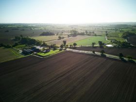
HIR projects, which are approved under the federal government's emissions reduction fund and overseen by the regulator, involve the regeneration of native forests by changing land management practices to achieve an increase in forest cover.
The methodology that underpins them is the single-biggest source of Australian Carbon Credit Units (ACCUs) in the country's domestic carbon market.
The research used the National Forest and Sparse Woody (NFSW) dataset Version 6 to 2021, which is used to prepare Australia's National Inventory Report, and noted that if changes in woody cover are not detected in the dataset, they are not counted towards Australia's emission reduction efforts.
The analysis used a recently launched web platform known as the Carbon Integrity Explorer, which allow users to see the project areas and 'carbon estimate areas' (CEAs) of HIR developments while using the NFSW dataset to assess the integrity risk associated with individual projects.
The CEA is defined as an area of land within a project area on which the eligible project activity is established and modelled for the purpose of calculating carbon abatement and issuing ACCUs.
The paper concluded that 25 million ACCUs issued to the projects between 2014 and 2021 had not delivered any climate mitigation benefits.
Satellite images 'not sufficient to make a judgement'
However, in response the CER and Australian government statement said CEA satellite images are "not sufficient, in and of themselves, to make a judgement about the performance of HIR projects".
They said that the CEA data "alone does not provide insight into the changed land management practices, nor readily show how much abatement has been achieved, particularly at the early stages of a project".
The statement said that in order to confirm abatement outcomes of HIR projects "audits, site visits, drone footage and geolocated photographs" are used by the regulator.
"The analysis in the paper is based on flawed assumptions about when projects started and the extent to which forests increased on areas of land in the CEAs," it added.
The statement also addressed some of the primary concerns raised by the paper and previous analysis of HIR projects that most of the schemes are located in areas have never been cleared, and grazing by animals "typically does not materially reduce tree and shrub cover in rangeland areas".
"There is no requirement in the HIR method, nor other legislation, for projects to be preceded by land clearing," CER and the government said.
They added that scientific literature supports the view that "grazing animals can stop trees reaching a forest, such as a study by Eldridge et al. (2016), which found that that overall 'ecosystem structure, function, and composition in rangelands are negatively affected by livestock grazing'".
Government and CER response questioned
However, ANU's MacIntosh questioned the government and CER's response to the paper, in particular the claim that CEA data and the NFSW dataset are insufficient to judge project performance alone.
He told Quantum that "from November 2021 until two days ago, the CER defended the performance of HIR projects using CEA data and the NFSW dataset ... (and so) what has now changed?".
He noted three examples of when this had occurred, including two reports on the CER's website – links one and two.
He also noted that the NFSW dataset is the only source of information relied on to track woody cover.
"It is generated using an internationally accepted method for estimating woody cover, which in simplified terms essentially measures 'greenness' of individual pixels at the driest part of the year.
"There is a degree of error in the dataset. However, the degree of underperformance of the projects is so large it makes the errors irrelevant. In simple terms, if our results are wrong because the NFSW dataset is wrong, it would mean: 1, the NIR land accounts is unreliable; and, 2, the science of tracking woody vegetation remotely is baseless."
In addition, MacIntosh also questioned the CER's assertion that ground measurements are also needed because satellite imagery isn't enough alone.
He said: "They are arguing that any changes in cover are so small that they can't be detected by satellites.
"This is likely to be true – to the extent the projects are successfully reducing grazing pressure, they are likely to result in small increases in woody biomass.
"But this is not what they are being credited for. They are being credited on the basis they are regenerating an even aged forest, starting from zero and growing towards the sites max carrying capacity.
"This means that, even in the best cases, where regeneration is occurring that is attributable to the project activities, the projects are still likely to be significantly over credited."
In addition, he said the best example in Australia of the impact of full grazing exclusion on woody cover is the Koonamore Station, which can be viewed on Google Maps.
This was established in the 1920s and from the early 1970s, has been "more intensively managed to exclude all ferals, including installing mesh fencing to the ground to keep out rabbits", he said.
"After almost 100 years, and 50 years of intensive exclusion, how much forest cover is there? Almost zero," MacIntosh said, adding that no HIR project is managed as well as Koonamore.